The advent of 3D Modeling Technologies in Golf Course Design has changed the way in which designers, architects and developers are conceptualizing , visualizing and optimizing golf courses. The application of advanced 3D modelling software together with real world terrain data enables golf industry professionals to create digital models of the golf course’s fairways, greens, bunkers and landscape, all of which are highly accurate representations of the golf course. This technology provides golf course developers with the tools to make informed decisions and avoid costly mistakes and supports the production of applications such as golf course 3D maps, simulations and planning for golf course construction that provide immersive visual experiences to the stakeholders involved in the project.
Understanding Project Requirements for Golf Course 3D Maps
The foundation of accurate golf course 3D maps lies in understanding project goals. Whether the model is for planning, marketing, or golf simulation 3D models, defining scope ensures the right level of detail, scale, and accuracy from the beginning.
Identifying the Purpose of the 3D Model
Clarifying whether the model is for design approval, player visualization, maintenance planning, or simulation determines modeling depth. A design-focused model prioritizes terrain precision, while marketing models emphasize aesthetics and realism for presentations and promotional use.
Defining Accuracy and Detail Levels
Not all projects require centimeter-level accuracy. Early decisions about contour precision, object density, and vegetation detail help balance performance and realism, especially when creating golf simulation 3D models or interactive experiences.
Establishing Software and Output Formats
Choosing compatible software and output formats ensures smooth integration with CAD, GIS, or game engines. This step avoids rework and supports efficient collaboration between designers, engineers, and visualization teams.
Setting Timelines and Budget Constraints
Clear timelines and budgets guide data resolution choices and workflow complexity. Well-defined constraints help teams deliver accurate 3D terrain modeling without compromising quality or exceeding project resources.
Collecting Real-World Data for 3D Terrain Modeling
Accurate 3D terrain modeling depends on high-quality source data. Terrain surveys, satellite imagery, and elevation datasets form the backbone of realistic golf course surfaces and ensure that slopes, elevations, and contours match real-world conditions.
Using LiDAR and Survey Data
LiDAR data provides highly precise elevation information, capturing subtle terrain variations. When combined with ground surveys, it ensures accurate representation of greens, fairways, and hazard areas critical to course design and playability analysis.
Integrating GIS and Satellite Imagery
GIS layers and satellite imagery add geographic context, boundaries, and land features. These datasets help align the 3D model with real-world coordinates, improving the reliability of golf course 3D maps for planning and analysis.
Verifying Data Accuracy and Consistency
Before modeling begins, all datasets must be checked for resolution mismatches and errors. Consistent, validated data ensures smooth terrain generation and prevents distortions in slopes, elevations, or course layouts.
Preparing Data for Modeling Software
Raw data often requires cleaning and conversion into compatible formats. Proper preprocessing streamlines the modeling workflow and improves accuracy when building detailed 3D golf course environments.
Building the Base Terrain for Golf Course 3D Maps
The base terrain is the structural core of golf course 3D maps. It defines elevation, slope, and landform characteristics that influence Golf Course Drainage Design, playability, and visual realism across the entire course.
Generating Digital Elevation Models
Digital Elevation Models (DEMs) convert raw elevation data into a usable surface. Accurate DEMs ensure smooth transitions between fairways, greens, and rough areas while maintaining true-to-life terrain behavior.
Refining Slopes and Contours
Fine-tuning slopes is essential for realistic ball movement and drainage simulation. Careful contour refinement enhances both functional accuracy and visual quality in 3D terrain modeling.
Aligning Terrain with Course Layout
The terrain must precisely match hole layouts, tee positions, and green locations. Proper alignment ensures that the digital model reflects real-world distances and elevation changes experienced by players.
Optimizing Terrain Mesh Density
Balancing mesh density prevents performance issues while preserving detail. Optimized terrain meshes are especially important for interactive golf simulation 3D models and real-time applications.
Adding Course Features and Environmental Details
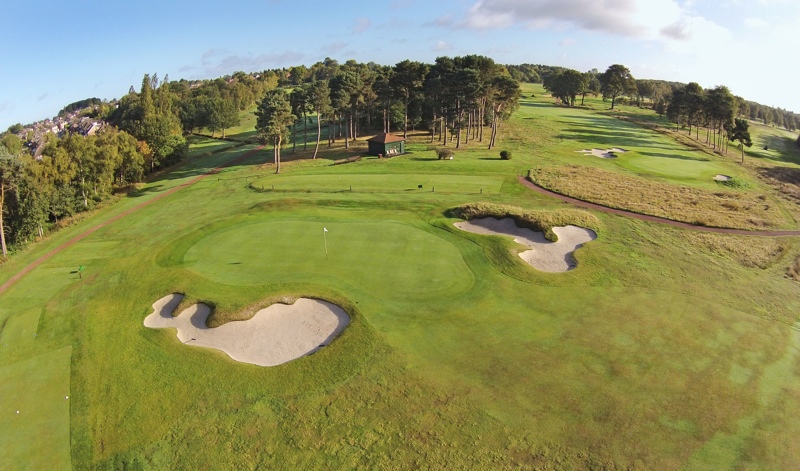
Beyond terrain, detailed features bring the golf course to life. Accurate modeling of bunkers, water hazards, vegetation, and pathways enhances realism and usability across design, visualization, and simulation platforms.
- Fairways, greens, tees, and rough areas
- Bunkers, water hazards, and elevation breaks
- Trees, landscaping, and the surrounding environment
Modeling Greens, Fairways, and Bunkers
Precise modeling of playable areas is critical for accuracy. Greens require smooth contours, while bunkers need correct depth and edges to reflect real-world play conditions and maintenance requirements.
Incorporating Vegetation and Natural Elements
Trees, grass types, and surrounding landscapes enhance realism. Proper placement improves visual immersion and helps stakeholders visualize how the course blends with its natural environment.
Adding Paths, Water Bodies, and Structures
Cart paths, bridges, clubhouses, and water features complete the environment. These elements add context and functionality to golf course 3D maps used for planning and presentations.
Ensuring Scale and Proportion Accuracy
Consistent scaling ensures that all features align correctly with terrain and layout. Accurate proportions are essential for realistic distances and believable course representation.
Validating and Exporting Golf Simulation 3D Models
Validation ensures that the final model meets accuracy standards and project goals. Proper exporting prepares the model for use in simulations, presentations, or interactive platforms.
| Validation Step | Purpose | Outcome |
| Terrain Check | Verify slopes and elevations | Accurate landform behavior |
| Feature Review | Inspect course elements | Consistent detailing |
| Format Testing | Test exports | Smooth integration |
Conducting Accuracy and Performance Checks
Comparing the model against original survey data ensures accuracy. Performance testing guarantees that the model runs smoothly in real-time environments or simulation software.
Exporting to Required Platforms
Models are exported to formats compatible with CAD tools, GIS systems, or game engines. Correct export settings preserve detail and accuracy across different applications.
Reviewing with Stakeholders
Stakeholder reviews help identify final adjustments. Feedback ensures the 3D golf course modeling output aligns with design intent and functional requirements.
Final Optimization and Delivery
Final optimization reduces file size without sacrificing quality. The completed model is then delivered, ready for design validation, visualization, or golf simulation use.
Frequently Asked Questions

Founder & CEO
Bigyan Kar is the driving force behind Geoshot Technologies and has been since its founding, leading the company’s vision in delivering advanced CAD, GIS, graphics, map illustrations, and 3D solutions across multiple industries. While Geoshot serves a wide range of sectors, Bigyan has maintained a strong specialization in golf course graphics.